ONE
25.06.2008 Wissenschaft idw
Fire Under the Ice
Anzeigen
International expedition discovers gigantic volcanic eruption in the Arctic Ocean
LINK
Visible increasing Antarctic volcanism by Ross Ice Sheet
check these MODIS images out, they are 9 meg TIF's, and look to the left of ross island, the channel you see in the last image is an icebreaker that cut a path to deliever supplies
ONE
TWO
THREE
FOUR
FIVE
Appears to be a massive 20 x 40 mile eruption
National Georgaphic News - click to wach video "Antarctics Big Meltdown" 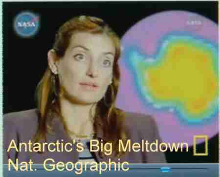
LINK
September 2007 mp3 Interview - LINK
The 5 meter Sea Level rise precedent LINK
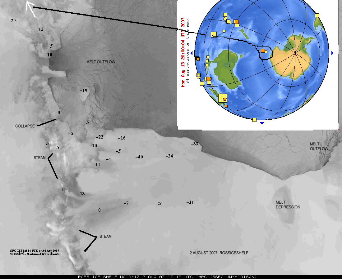 3 August 2007 LATEST IMAGE with location of 3 August 5.7 Earthquake at end of Transantarctic mountains - multiple steam events and meltwater outflows visible
In September 2006 I noticed massive outpourings of water from underneath the ross ice sheet, all efforts to bring this to the attention of those that study these things seemed to no avail, now, nearly a year later, it appears there is acknowlegement that what I saw in the images shown below, was in fact, something of great importance.
"The six experts described the Earth as being in "imminent peril" and warned that a UN panel on climate change grossly underestimated the scale of sea-level increases this century. In an article published in the journal the "Philosophical Transactions of the Royal Society A.", the group led by James Hansen, the director of NASA's Goddard Institute for Space Studies wrote: "Recent greenhouse gas emissions place the Earth perilously close to dramatic climate change that could run out of control, with great dangers for humans and other creatures." The paper predicts that sea levels may rise by several metres by 2100, compared with a forecast from the UN Intergovernmental Panel on Climate Change published in February that predicts sea levels increasing between 18 and 59 centimetres. LINK
 Link to Scientific Retience, "The Problem is Non-linear" May 24th 2007
Analysis Finds Large Antarctic Area Has Melted. May 16, 2007, Wednesday By ANDREW C. REVKIN (New York Times)
May 18, 2007 - Antarctica: Unprecedented Western Ice Melt and CO2-Saturated Southern Ocean.
"The western Antarctic ice melt was unprecedented. Wed never seen anything like this in the past 25 years." - Ted Scambos, Ph.D., Glaciologist, NSIDC
May 18, 2007 Nature Magazine - Sea Level Rise Quickening in Pace
Grist Mill - Sea level rise of 5 meters in one century?
An interesting overview by a guy that sounds like he knows what he is talking about HERE
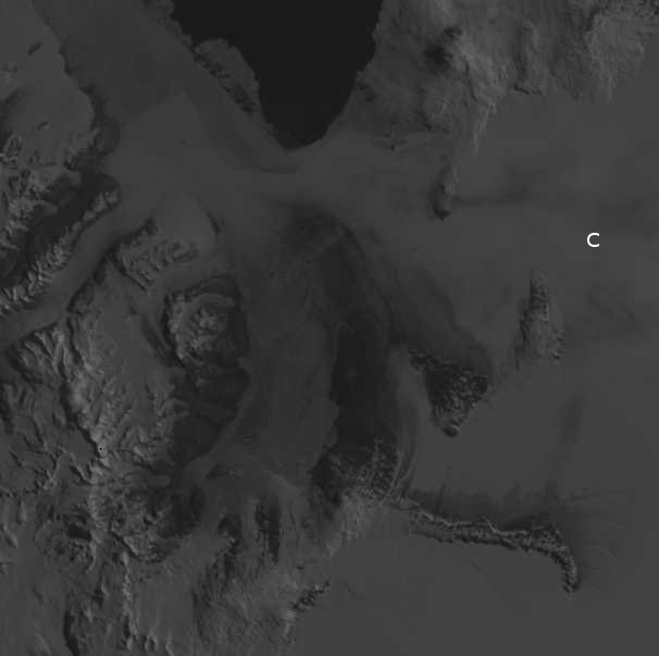
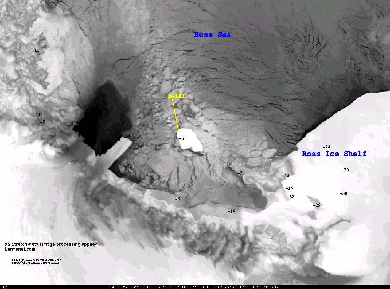
Image enhanced May 25th 2007 MODIS imagery, Ross Island:
MODIS Imagery LINK
I received a very pleasant email in september 2006, from SSEC/UW but I don't believe a word of it
Hello Arnaldo,
Thanks for your e-mail. Actually, what is occurring around Ross Island maybe more to natural sea ice formation and movement out of the region out into the greater Ross Sea, rather than a "melt" per se. For the past several years tabular iceberg have blocked much of the sea ice from having an easy access to moving away from the region. Now, only one tabular iceberg, B-15J, remains. Hence, sea ice, under influence of wind and wind stress, as well as other forces, moves the sea ice around much more dynamically without those tabular icebergs around.
Over the last 72 hours, the Ross Island region is being affected by a significant late winter storm, which will affect the sea ice around the area (due to high winds, etc.). It may also be a catalyst for opening up small polnya, or patches of unfrozen ocean, near by. Hence, it looks like the region has sea ice "melting" when it really is not. The sea ice is simply pushed away from the region.
I hope this helps!
Best Regards,
xxxxxxxxx (deleted)
On Sep 17, 2006, at 10:14 AM, arnaldo lerma wrote:
>  Email sent by arnaldo lerma via http://www.ssec.wisc.edu/cgi-bin/email_form.cgi
(email link on http://amrc.ssec.wisc.edu/iceberg.html used):
 hi, whats with the huge ice melt around ross island?

------------------------------------------------------------------------
xxxxxx-xxxxxxxx -Meteorologist- Antarctic Meteorological Research Center
947 Atmospheric, Oceanic and Space Sciences    http://amrc.ssec.wisc.edu
Space Science and Engineering Center         E-mail: xxxxx@ssec.wisc.edu
University of Wisconsin-Madison                    Phone: (608) 262-0436
1225 West Dayton Street, Madison, WI 53706           Fax: (608) 263-6738
------------------------------------------------------------------------
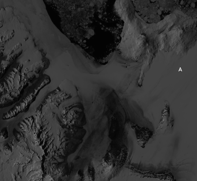
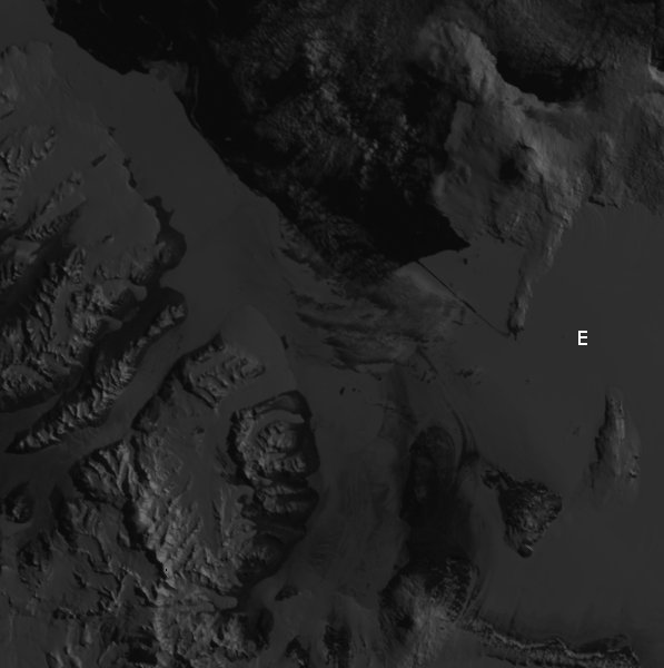
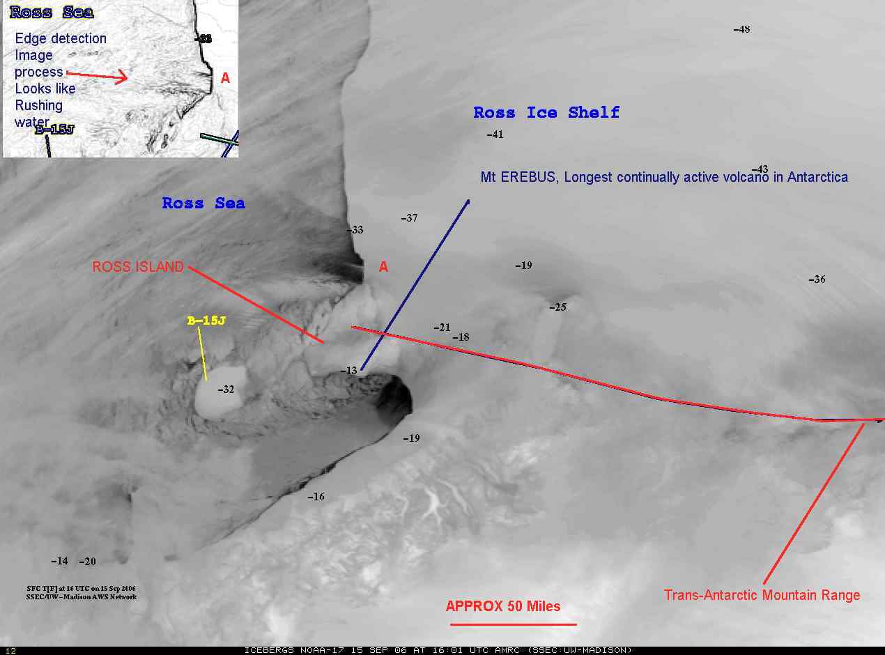
For many years, each morning I have been watching the satellite imagery of the Ross ice sheet, this morning I noted what appears to be a large undersea volcano, melting the ice of the Antarctic ice sheet. Note the flows on either side of Ross island have in one day, washed away the pack ice!
A web search this morning indicates no mention of this anomaly in the news. Temperatures are indicated by the black numbers in degrees Farenheit
Click image above for full image with annotations by Arnie Lerma and image enhancement of flow
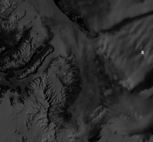
Original images are linked form THIS page Tell me what you think Seems the same area is NOT available in the September 19th images
However... look at what is, the annotations are mine... click on that image to goto the original from THIS PAGE
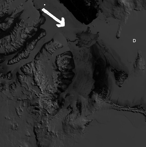
For an undetermined length of time following this event Telemetry from McMurdo was "unavailable" An over view map show what is where is HERE NARRATOR: But where is the water coming from? Why is the base of the ice melting? While flying over the ice sheet, Don Blankenship's sensors picked up evidence of magnetic rock, and a cone-shaped mountain beneath the ice. At the surface, there was a round depressionfour miles wide.
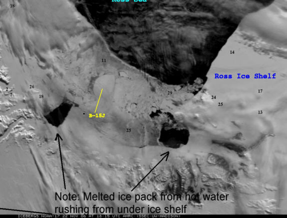
NARRATOR: It was an active volcano, melting the bottom of the ice. Even a volcano isn't enough to destroy an entire ice sheet, but it is evidence of some major geological activity. Don made his discovery just west of the Transantarctic Mountains. Here, two continental plates have moved apart. In the middle, the earth's crust is very thin, allowing heat to flow up from below. This could be contributing water to the base of the ice streams. But scientists worry there could be an additional source of heat. Compare above to 22 November 2006 images clearing showing renewed icemelt
Vindication?:
29 November 2006
Massive ice shelf 'may collapse without warning'
1.00pm Wednesday November 29, 2006
The Ross Ice Shelf, a massive piece of ice the size of France, could break off without warning causing a dramatic rise in sea levels, warn New Zealand scientists working in Antarctica.
A New Zealand-led ice drilling team has recovered three million years of climate history from samples which gives clues as to what may happen in the future.- LINK to originala rticle at the New Zealand Herald
Jan 3rd, 2006
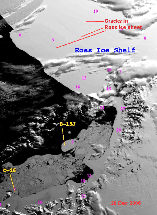
Cracks 100's of miles long appearing in antarctic ross ice shelf
This image from Dec 28th 2006 clearly shows 3 enormous cracks in the Ross ice shelf, complete collapse of the Ross shelf would raise sea levels, flooding parts of manhattan island.
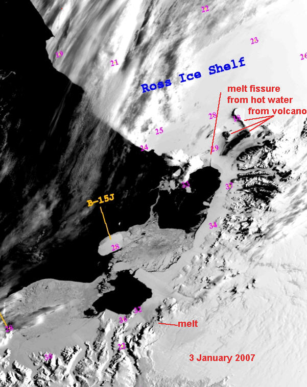
This image from Jan 3rd 2007, shows a new melt water fissure, and the breakup of the "fast ice" that was previously north of ross iceland.
Goto latest images at wisc.edu
Eruptions at the volcano on Mt Erebus on Ross Island were recently the highest in recorded history in 2007
LINK - A interesting graph of total earthquake activity by year, 2007 as of Sept 4, is at 85, highest ever.. - consider what would be the consequence of a good sized earthquake under the the ross ice sheet? This awful page was cobbled together by Arnie Lerma
http://amrc.ssec.wisc.edu/iceberg.html
September 14 NOAA images This is the source file for the top image.
September 15 NOAA images This is source file for the bottom half of the image
Arnie Lerma
alerma@verizon.net
703-241-1498

NOVA - Warning in the ICE - Excerpt - original from 1998HERE
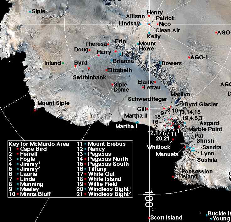
The show above was describing an area just to the the RIGHT of ross island, Ross island is the end of the chain of mountains in the tran-antarctic mountain range. This is the location we are looking at! - A week has gone by and there has not been any updated imagery of ross island and the transantartctic mountains
